Quantcast
Channel: Bridge of the Week
Viewing all 594 articles
Browse latest View live

Napa County, California Bridges: Larkmead Lane across the Napa River

$
0
0
December 2013 (38.56057 Degrees, -122.52206 Degrees) Larkmead Lane Bridge
Continuing up the Valley we came to the Larkmead Lane Bridge (21C0061) across the Napa River. This two span 'T' girder bridge has a decorative pier wall with a diaphragm that descends slightly below the girders. The bridge was built in 1926 and it's composed of two 42 ft long spans and a 20 ft wide deck. Perhaps the fad for stone masonry arch bridges had diminished by the 1920s or maybe they just wanted a bridge with more headroom.
An interesting suspension bridge sits next to the 'T' girder bridge complete with 'mini' towers. I'm surprised they just didn't put this pipe in the roadway bridge instead of building a separate bridge.
There's apparently a two span stone masonry arch bridge on Larkmead Lane over Dutch Henry Creek that I missed, but fortunately Craig Philpott took some photos of it for the Bridgehunter Website.
Creative Commons License
Napa County, California Bridges: Larkmead Lane across the Napa River by Mark Yashinsky is licensed under a Creative Commons Attribution-NonCommercial-NoDerivatives 4.0 International License.

Napa County, California Bridges: Foothill Blvd (SR28/129) Bridges in Calistoga

$
0
0
December 2013 (38.56636 Degrees, -122.56324 Degrees) Foothill Blvd. Bridges
I'm going to incorporate the remaining bridges on Foothill Blvd (SR28/129) in Napa County into a single blog. The Diamond Mountain Creek Bridge (21C0060) is a stone masonry arch that is 22 ft long but was widened to 44 ft with a box girder bridge on the east side in 1988. I took a photo of the widening and Craig Philpott has a nice photo of the transition from new to old on the Bridgehunter Website.

The Cyrus Creek Bridge (21 0027) is a 60 ft long single span CIP box girder superstructure that was built in 1993. The Blossom Creek Bridge (21 0068) was a stone arch that was built 1901 but was completely rehabilitated in 1993 covering the original arch bridge. I didn't photograph either of these bridges.

The last bridge on Foothill Blvd (before we entered Sonoma County) is another stone arch over Blossom Creek (shown below) that was built in 1905 but doesn't have a bridge number. We are at the north end of the town of Calistoga, which has geysers, hot springs, and other tourist attractions. We'll study a couple of other bridges in Calistoga tomorrow.
Creative Commons License
Napa County, California Bridges: Foothill Blvd (SR28/129) Bridges in Calistoga by Mark Yashinsky is licensed under a Creative Commons Attribution-NonCommercial-NoDerivatives 4.0 International License.

Napa County, California Bridges: Garnet Creek Bridges in Calistoga

$
0
0
December 2013 (38.6033 Degrees, -122.5887 Degrees) Garnet Creek Bridges
The Lake County Highway (SR 29) Bridge (21 0005) is a three span stone arch that was built in 1902. This bridge was registered as a historic place in 2005. The bridge was designed by JM Graham and built by HW Wing who supplied the stone for many of the old structures that are still standing in Napa County.
The bridge is 81 ft long and only 19 ft wide and carries over 4000 vehicles a day. The Weekly Calistogan writes that Caltrans would like to preserve the existing bridge and/or build a new bridge to carry traffic but there is opposition to both options from residents. They don't want to see any of their vineyards converted into a roadway and they also don't want to have a historic bridge demolished. 
Erosion is damaging the bridge foundations and arches, heavy truck traffic is damaging the deck, and the bridge is too narrow to safely carry two lanes of traffic.
Another historic bridge crosses over Garnet Creek in Calistoga. The Greenwood Avenue Bridge (21C0042) is a single span stone arch that was built in 1904 (see photo above). It's 50 ft long, only 17 ft wide, and registered as a historic place in 2005. The bridge was designed by Oliver Buckman and built by John Money. The area surrounding the bridge is so full of brambles that I wasn't able to get under the bridge.
Creative Commons License
Napa County, California Bridges: Garnet Creek Bridges in Calistoga by Mark Yashinsky is licensed under a Creative Commons Attribution-NonCommercial-NoDerivatives 4.0 International License.

Napa County, California Bridges: Aetna Springs Road Bridge across Swartz Creek

$
0
0
December 2013 (36.65338 Degree, -122.47640 Degrees) Aetna Springs Road Bridge
I often see fencing under bridges but I don't understand why. Is it to prevent livestock from escaping under the bridge?
East of Napa Valley is Pope Valley, which isn't as famous but has many vineyards and many old arch bridges. The first bridge we arrived at in Pope Valley was the Aetna Springs Road Bridge (21C0046) over Swartz Creek. It's a single span stone arch bridge that was built in 1912. The bridge is 54 ft long but only 15 ft wide.
A new sign was erected that is in sharp contrast to the old bridge. Aetna Springs Road Bridge was registered as a historical place in 2005, like many of the other old arch bridges in Napa County. The registration states:'Napa County Surveyor, O.H. Buckman, designed the Swartz Creek Bridge in 1912. Buckman served as a Napa County Surveyor from 1895 until about the time of World War I. The abundance of masonry arch bridges in Napa County is primarily due to his design efforts. This bridge was built by contractor A.C. Martini for a cost of $2549.50.
Creative Commons License
Napa County, California Bridges: Aetna Springs Road Bridge across Swartz Creek by Mark Yashinsky is licensed under a Creative Commons Attribution-NonCommercial-NoDerivatives 4.0 International License.

Napa County, California Bridges: Pope Canyon Trail across Pope Creek

$
0
0
December 2013 (38.64688 Degrees, -122.36591 Degrees) Pope Canyon Trail Bridge
There's an interesting old bridge that used to carry Pope Canyon Road but that road was realigned in 1986 and so now the bridge carries Pope Canyon Trail. This arch bridge across Pope Creek is 45 ft long and only 16 ft wide. It's a concrete deck arch with stone masonry abutments.  
The new Pope Canyon Road Bridge (21C0118) is a very ordinary two span precast I girder bridge supported by a pier wall and seat-type abutments built in 1986. The spans are 114 ft long, its on a 35 degree skew, and it only carries about 250 vehicles a day.
Creative Commons License
Napa County, California Bridges: Pope Canyon Trail across Pope Creek by Mark Yashinsky is licensed under a Creative Commons Attribution-NonCommercial-NoDerivatives 4.0 International License.

Napa County, California Bridges: Knoxville-Berryessa Road Bridge across Eticuera Creek

$
0
0
December 2013 (38.71462 Degrees, -122.26072 Degrees) Knoxville Road Bridge
The Knoxville Road Bridge (21C0074) across Eticuera Creek is a T girder bridge in a style very similar to the Pratt Avenue Bridge we studied last week with big exterior girders and diminutive interior girders. It's an interesting design with floor beams helping to support the deck. 
The county engineer was Edward Ball, the designer was Hal Sams, and the builder was Harry Thorsen.  It says something about how much pride Napa County has in their bridges that they usually include a plaque with the names of the people responsible for each bridge.
The bridge has deteriorated a great deal since it was built in 1920 and so they're holding a public hearing to post weight restrictions on the bridge. It carries about 250 vehicles a day and has a sufficiency rating of 25.
There is an abandoned arch bridge nearby over a tributary of the Eticuera Creek but I wasn't able to find it. Fortunately, Craig Philpott has a pohto of it in the Bridgehunter Website.
Creative Commons License
Napa County, California Bridges: Knoxville-Berryessa Road Bridge across Eticuera Creek by Mark Yashinsky is licensed under a Creative Commons Attribution-NonCommercial-NoDerivatives 4.0 International License.

Napa County, California Bridges: Lake Berryessa Bridges

$
0
0
December 2013 (38.61689 Degrees, -122.28934 Degrees) Lake Berryessa Bridges
Lake Berryessa was formed by damming Putah Creek (a three span stone arch bridge is submerged under the lake). We have previously followed Putah Creek through Yolo County. To the west in Napa County the creek is larger, and it has formed one of the largest reservoirs in California (see photo below). The bridges cross on the west side where Putah and Pratt Creek empty into the lake. The Knoxville-Berryessa Road Bridge (21C0014) across Putah Creek is a six span steel girder bridge on two column bents. Its 818 ft long (with a 166 ft long main span), 24 ft wide, and built in 1957.
The Knoxville-Berryessa Road Bridge (21C0013) across Pratt Creek is a four span steel girder bridge on two column bents and pile extension approach spans. This bridge is 703 ft long (with a 166 ft long main span), 24 ft wide, and built at the same time as the bridge to the north was built.
Creative Commons License
Napa County, California Bridges: Lake Berryessa Bridges by Mark Yashinsky is licensed under a Creative Commons Attribution-NonCommercial-NoDerivatives 4.0 International License.

Napa County, California Bridges: Maxwell Creek Bridges

$
0
0
December 2013 (38.6016 Degrees, -122.3681 Degrees) Maxwell Creek Bridges
Two bridges were built where Maxwell Creek crosses near the intersection of Hardin and Dollarhide Roads (see Google earth photo). The Hardin Road Bridge (21C0058) is the bigger structure. It's a tall stone arch bridge built in 1909. Like the other historic bridges in Napa County, it was registered in 2005.
The registration states, "The Maxwell Creek Bridge is a single 22.5 foot long, earth filled closed spandrel masonry arch. This 2 lane bridge has a length of 38 feet and a width of 19.7 feet. The masonry structure is comprised of square cut stone laid in regular courses. Both railings are comprised of square cut stone. A rural setting of trees and fields surrounds the bridge. The availability of high quality building stone from nearby sources and the presence of skilled stonemasons can be seen in the many stone buildings and bridges that still exist throughout the county. This bridge is located on Hardin Road 1.6 miles southeast of Pope Canyon Road. Napa County Surveyor, O.K. Buckman, designed the Maxwell Creek Bridge in 1909. Buckman served as a Napa County Surveyor from 1895 until about the time of World War I. The abundance of masonry arch bridges in Napa County is primarily due to his design efforts. This bridge was built by contractor J.B. Newman for a cost of $1875. Newman was one of the primary masonry bridge contractors in Napa valley in the late nineteenth and early twentieth centuries. For all intents and purposes, this bridge retains its original appearance." 
The Dollarhide Road Bridge over a tributary of Maxwell Creek was built in 1910. It's not a county bridge and it's a much smaller structure than the Hardin Road Bridge which may explain why it hasn't been registered as a historic place.
 The Dollarhide Road Bridge is only 12 ft long and 19 ft wide. It includes a step dam on the downstream side of the bridge.
Creative Commons License
Napa County, California Bridges: Maxwell Creek Bridges by Mark Yashinsky is licensed under a Creative Commons Attribution-NonCommercial-NoDerivatives 4.0 International License.

Napa County, California Bridges: Chiles Pope Valley Road Bridge across North Branch of Chiles Creek

$
0
0
December 2013 (38.54974 Degrees, -122.35629 Degrees) Chiles Pope Valley Road Bridge
Continuing south down Pope Valley we came to a little bridge on Chiles Pope Valley Road. The stone arch sits on stone retaining walls giving it increased headroom. At one point the bridge was widened and so it is a half stone - half concrete arch bridge.
I noticed in Craig Philpott's photos from 2009 in the Bridgehunter Website that the concrete portion has a corrugated metal liner, which must have been used for formwork to cast the widening and then removed.
Creative Commons License
Napa County, California Bridges: Chiles Pope Valley Road Bridge across North Branch of Chiles Creek by Mark Yashinsky is licensed under a Creative Commons Attribution-NonCommercial-NoDerivatives 4.0 International License.

Napa County, California Bridges: Chiles Pope Valley Road Bridge across Chiles Creek

$
0
0
December 2013 (38.50840 Degrees, -122.35395 Degrees) Chiles Pope Valley Road Bridge
This Chiles Pope Valley Road Bridge (21C0076) was built in 1910. It's 25 ft long and was widened on the east side (like the previously studied bridge) with concrete. It appears they took the existing stone barrier and moved it onto the wingwalls and closed spandrel wall of the widening.
We can see the same names as on many of the other historic Napa County bridges.

Napa County Surveyor, O.H. Buckman also designed the Swartz Creek Bridge in 1912. Buckman served as a Napa County Surveyor from 1895 until about the time of World War I. The abundance of masonry arch bridges in Napa County is primarily due to his design efforts. This bridge was built by contractor A.C. Martini as were many other bridges in Napa County. 

The reason this bridge wasn't selected as a historic place was probably because it was widened. The National Registry of Historic Places wants their bridges unaltered.
Creative Commons License
Napa County, California Bridges: Chiles Pope Valley Road Bridge across Chiles Creek by Mark Yashinsky is licensed under a Creative Commons Attribution-NonCommercial-NoDerivatives 4.0 International License.

Napa County, California Bridges: State Route 128 across Soda Creek

$
0
0
December 2013 (38.50167 Degrees, -122.25667 Degrees) Soda Creek Bridge
I drove past Sage Creek Bridge on SR 128 (a concrete arch bridge built in 1945) on my way to today's structure, the Soda Creek Bridge. Fortunately, Craig Philpott photographed Sage Creek for the Bridgehunter Website. Soda Creek Bridge is on a high skew under State Route 128. In a previous blog I wondered how one builds a skewed arch bridge. In this case you just build the arch longer, but at an angle to the road.
The Soda Creek Bridge is only 16 ft long and it was built in 1910. State Route 128 got widened in 1955 and I noticed that the bridge has a large corrugated metal arch culvert on the east side that was used for the widening. It looks like it was used as a form since I can see concrete above the metal.
Creative Commons License
Napa County, California Bridges: State Route 128 across Soda Creek by Mark Yashinsky is licensed under a Creative Commons Attribution-NonCommercial-NoDerivatives 4.0 International License.

Napa County, California Bridges: State Route 128 Bridge across Capell Creek

$
0
0
December 2013 (38.48389, -122.24222) State Route 128 Bridge
State Route 128 across Capell Creek (21 0078) is a three span continuous steel girder bridge built in 1956. Its 205 ft long with a 20 degree skew and an 80 ft long center span. The bridge has very tall two column bents with short pier walls at the bottom. The columns have a 'U' shape with the rounded ends on the outside of the bent (see bridge plan drawing below). 

I visited this bridge twice, but I had trouble photographing it because there was so much brush and water around it.
I reviewed the plans, which showed a 60" deep by 5/8" thick web with 12" wide flanges. The superstructure cantilevers 12' past the bents with a 56' long drop-in span set in the middle. The bridge was retrofitted with cable restrainers in 1983. New stiffeners and cross-braces were provided to the girders above the abutments in 1998 (perhaps 5/8" webs were too thin?). The backside of the abutments were also repaired. In 2003 the deck was cleaned, repaired, and treated with methacrylate.
The bridge was inspected in 2012 and was appraised as functionally obsolete with a sufficiency rating of 65 out of 100, perhaps because the deck is only 32 ft wide or because it's almost 60 years old. In the 2010 inspection report $1 million of work was recommended for 'general structural deterioration and inadequate strength.'
Creative Commons License
Napa County, California Bridges: State Route 128 Bridge across Capell Creek by Mark Yashinsky is licensed under a Creative Commons Attribution-NonCommercial-NoDerivatives 4.0 International License.

Napa County, California Bridges: State Route 121 across Capell Creek

$
0
0
December 2013 (38.43028, -122.20833) State Route 121
The State Route 121 Bridge (21 0009) is a two span stone arch over Capell Creek that was built in 1907. I've written before that I dislike two span arch bridges because they look like someone is staring at me. Like many of the other bridges in Napa County, it was rehabilitated in the 1950s with a reinforced concrete widening (see below).
Creative Commons License
Napa County, California Bridges: State Route 121 across Capell Creek by Mark Yashinsky is licensed under a Creative Commons Attribution-NonCommercial-NoDerivatives 4.0 International License.

Palm Beach County, Florida Bridges: West Lake Road Bridge across the Okeechobee Rim Canal

$
0
0
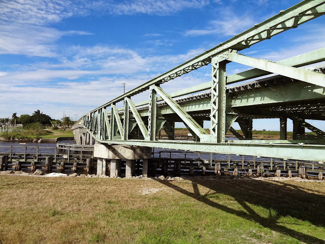
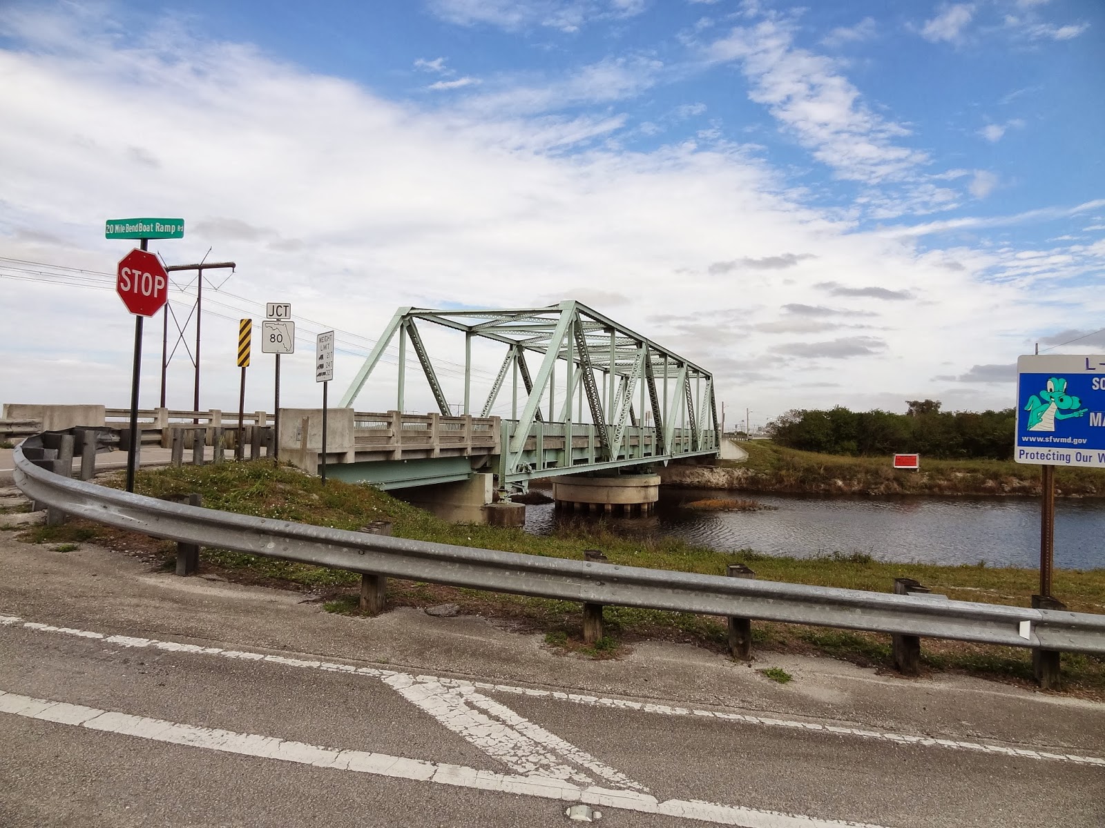
January 2014 (26.7055 Degrees, -80.7129 Degrees) West Lake Road Bridge
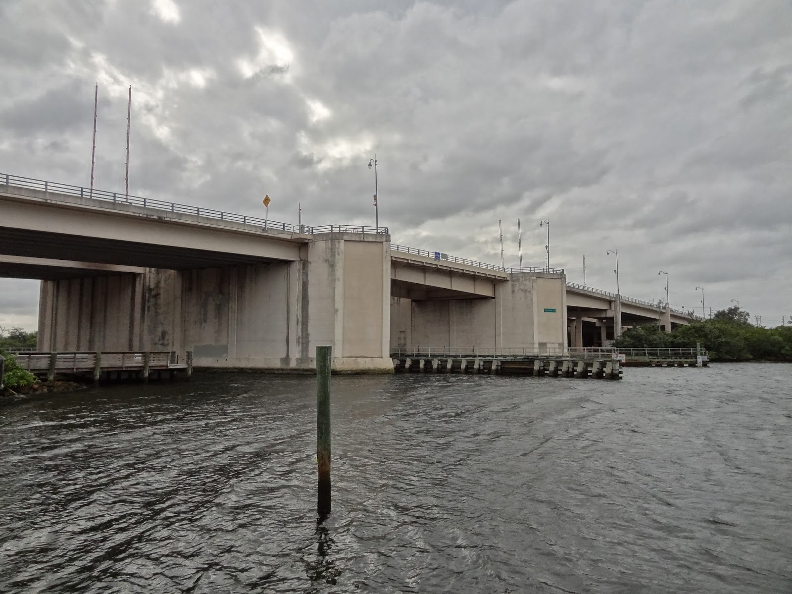
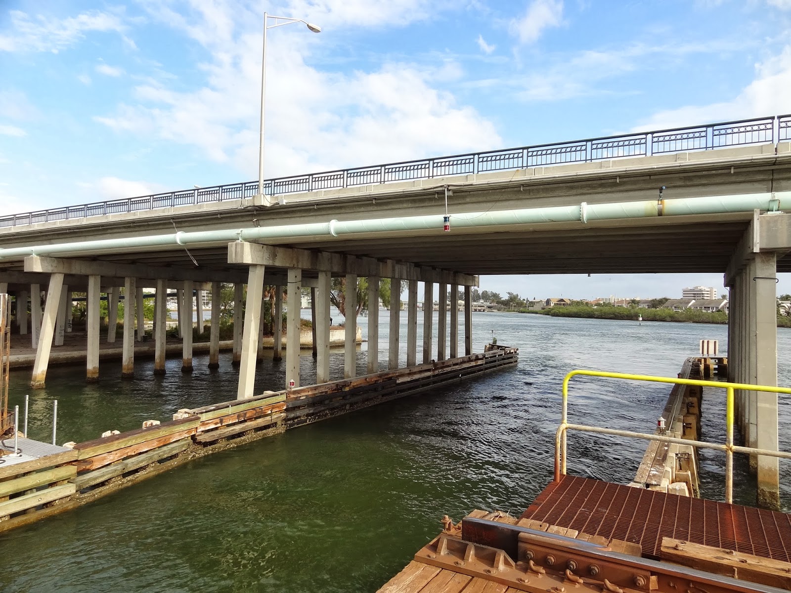
I visited my mother in Florida again this year and while I was there I took some more bridge photos. Last year I photographed Palm Beach County bridges and I continued shooting them this year. What's interesting about these structures is that they are mostly moveable bridges.

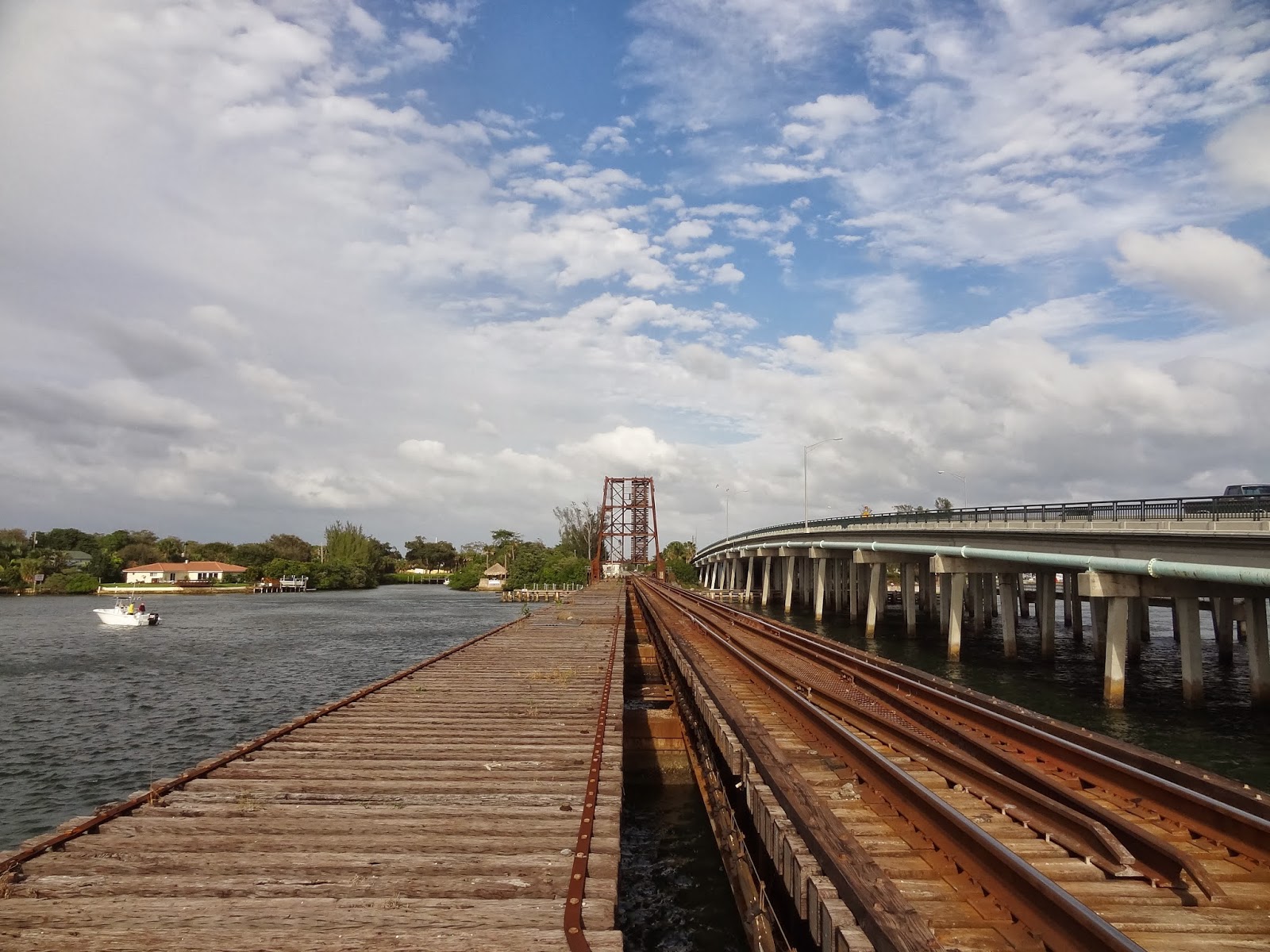
Southern Florida is dominated by Lake Okeechobee with interesting bridges connecting the mainland to  islands on the sides of the lake. Today's structure is called the Belle Glade Bridge, the Torrey Island Bridge, the Point Chosen Bridge but I'm going to call it the West Lake Road Bridge (FDOT#930072) across the Okeechobee Rim Canal.
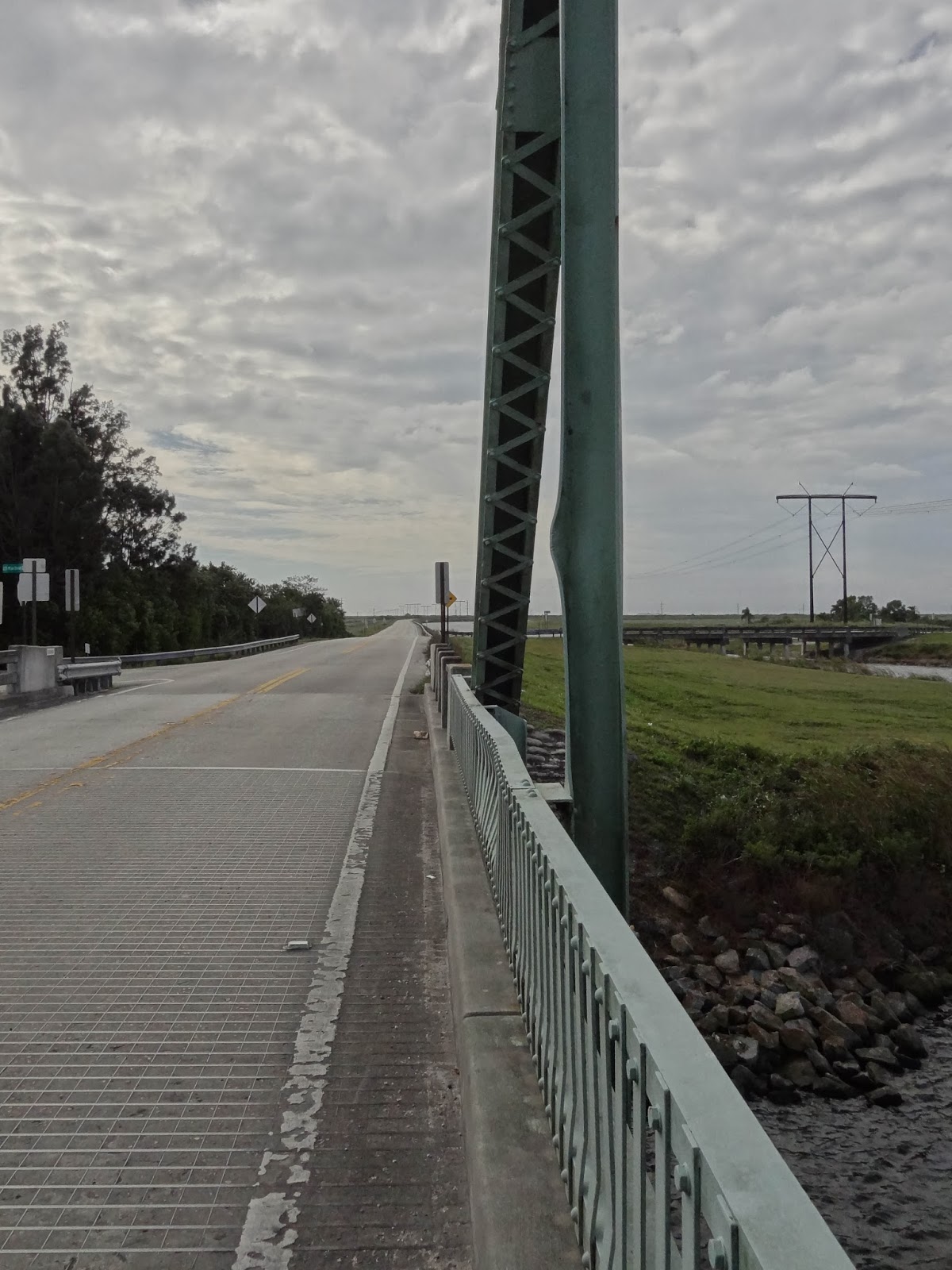
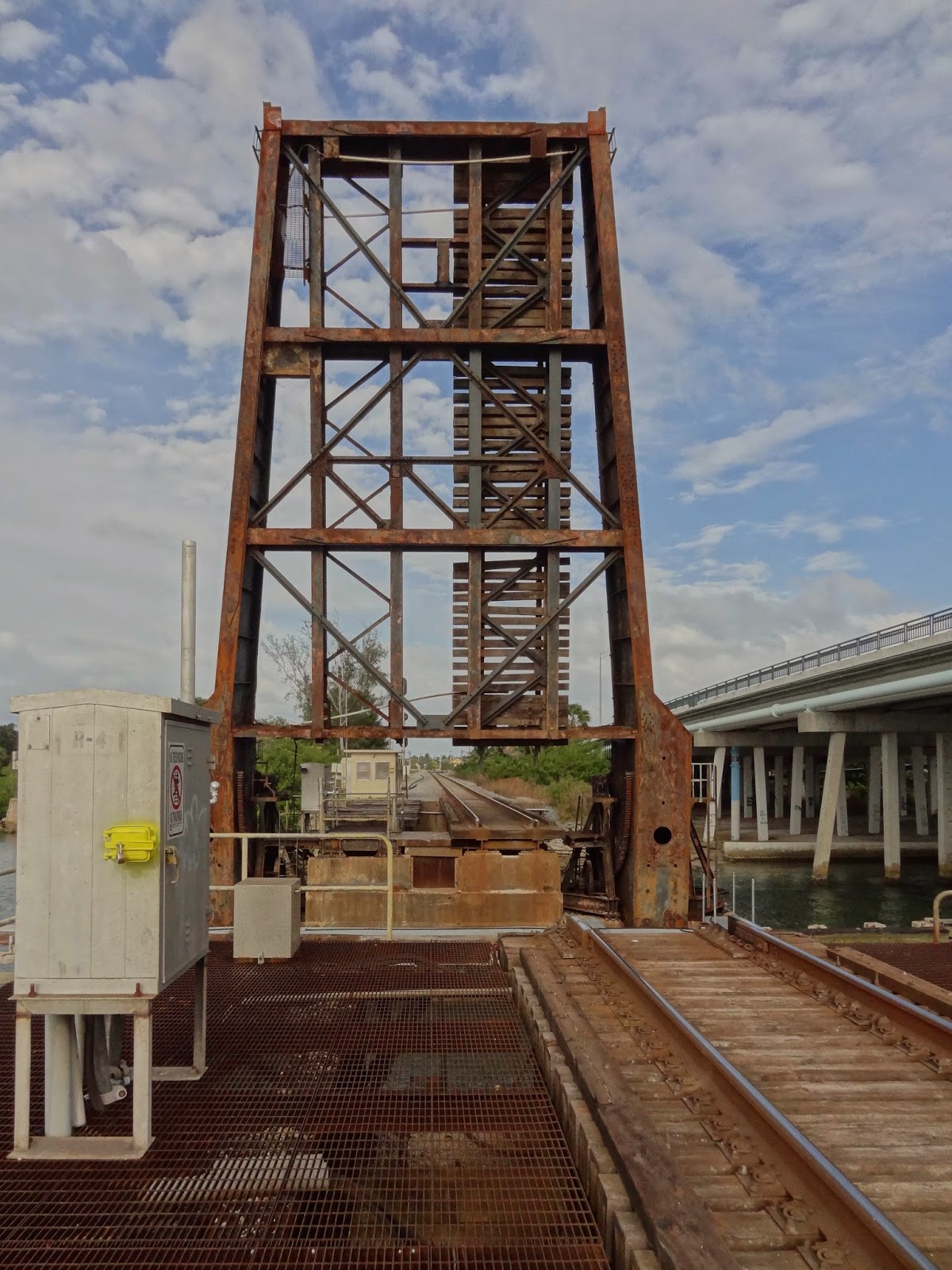
As you can see, this is a swing bridge with a pony truss superstructure. The top chords are horizontal and above the deck. The bottom chords slope upward from the center pier and the diagonal members slope downward toward the ends. I guess it's a half-hipped Allan truss bridge. The bridge cantilevers out from the center pier and so the diagonal members are in tension.
This bridge is one of the few bridges that can be swung around by hand. The bridge tender stands on the metal deck with a rod that is inserted into one of the two small gears on either side of the big central gear (see photo below). Then, they hold the handle and walk around the tool until the superstructure is parallel with the canal. A photograph of a bridge tender rotating the bridge by hand is on the Internet.
There's a metal plaque next to the bridge with the names of the principal bridge tenders after construction was completed in 1935.  Sellie 'Slim' Corbin was the tender until 1965 and Charles and Gordon Corbin were the tenders until 2005. Probably boat owners must request bridge openings weeks in advance.
Creative Commons License
Palm Beach County, Florida Bridges: West Lake Road Bridge across the Okeechobee Rim Canal by Mark Yashinsky is licensed under a Creative Commons Attribution-NonCommercial-NoDerivatives 4.0 International License.

Martin County, Florida Bridges: Port Mayaca Railroad Bridge across St Lucie Canal

$
0
0
January 2014 (26.98736 Degrees, -80.60430 Degrees) Port Mayaca Railroad Bridge
After visiting the West Lake Road Bridge, I drove north along Lake Okeechobee to another interesting movable bridge. The Port Mayaca Railroad Bridge is a steel girder bridge with a lift span over the Saint Lucie Canal. The South Central Florida Express (SCFX) Railroad is a short line owned by U.S. Sugar. According to "Movable Bridge Engineering," by Terry L. Koglin, the bridge was built in 1925, spans a 56 ft wide canal, and provides 48 ft of vertical clearance. The Saint Lucie Canal empties into the Intercoastal Waterway 38 miles to the east in Stuart, Florida.
Lake Okeechobee would flow into the canal except there's a gate between the canal and Lake Okeechobee. I read that the gate is to keep the polluted water from flowing out of Lake Okeechobee. I drove to the gate and walked along a Florida Water Management utility road to get an elevation view of the bridge. The photo above shows that the main span is a four-legged structure with counterweight sheaves that can raise and lower a pony plate girder movable span. You can see the counterweights just above the tracks.
Creative Commons License
Martin County, Florida Bridges: Port Mayaca Railroad Bridge across St Lucie Canal by Mark Yashinsky is licensed under a Creative Commons Attribution-NonCommercial-NoDerivatives 4.0 International License.

Martin County, Florida Bridges: State Route 15 Bridge across St Lucie Canal

$
0
0
January 2014 (26.98861 Degrees, -80.61806 Degrees) SR15 Bridge
A little west of the Port Mayaca Railroad Bridge is the US441/SR15 Bridge (FDOT#890103) over SR76 and the St. Lucie Canal. It's a 25 span precast girder bridge built in 1983. In the photo above we can see the gate holding back Lake Okeechobee just behind the bridge. Note that the girders are deeper on the long spans over canal.
This bridge is a series of simple spans without a continuous deck for live load. Consequently, when I stood on the deck to photograph the Port Mayaca RR Bridge, I was shaken by every truck that drove by.The bridge is 2460 ft long with 130 ft long spans over the canal.
The bridge is supported on two column bents with a cross-beam between the columns (and with a pier wall at the bottom of the bents close to the canal). The bridge is quite tall and so it must climb very quickly from the ground to get over the canal. We can see old timber piles/fenders downstream of the current bridge, suggesting that an earlier bridge may have been at this site. However, I couldn't find any information about such a bridge.
Creative Commons License
Martin County, Florida Bridges: State Route 15 Bridge across St Lucie Canal by Mark Yashinsky is licensed under a Creative Commons Attribution-NonCommercial-NoDerivatives 4.0 International License.

Palm Beach County, Florida Bridges: Connors Highway (SR 700) Bridge across the Loxahatchee River

$
0
0
January 2014 (26.68528 Degrees, -80.38889 Degrees) Twenty Mile Bend Bridge
My main reference for Florida bridges is the 'Historic Highway Bridges of Florida' by the Florida DOT. They said about today's bridge, "The Twenty Mile Bend Bridge, or Loxahatchee River Bridge features a 188 ft long Warren through truss mounted on a center-point pivot. The steel for this bridge carries the mill marks of 'Carnegie USA.'"
The Twenty Mile Bend Bridge (FDOT#930940) is a swing bridge that was built in 1937. It's made up of laced and wide flange members, a couple of which were bent, probably from a vehicle collision. The laced members are connected with rivets and I noticed that some of the members were stamped with 'Tennessee' but I didn't notice 'Carnegie' on members.
The bridge includes a steel girder approach span on the west side of the bridge. This site is where several canals come together and we can see an old concrete slab bridge on multicolumn bents in the distance in the photo above. Several different transmission lines also run through this bridge site. The bridge borders the Loxahatchee Wildlife Refuge.

The Twenty Mile Bend Bridge is the second oldest bridge in Palm Beach County. The bridge is in good shape and got a sufficiency rating of 46 out of 100. I didn't see any sign that the bridge can still be swung. There didn't appear to be any boats in the canal and it looked like this is another bridge that would have to be moved by hand.
Creative Commons License
Palm Beach County, Florida Bridges: Connors Highway (SR 700) Bridge across the Loxahatchee River by Mark Yashinsky is licensed under a Creative Commons Attribution-NonCommercial-NoDerivatives 4.0 International License.

Palm Beach County, Florida Bridges: State Route 706 Bridges across the Intracoastal Waterway

$
0
0
January 2014 (26.93389 Degrees, -80.08333 Degrees) Indiantown Road Bridges
Continuing to the northeast, we arrived at the City of Jupiter, which is intersected by many bodies of water (see Google earth photo below).
The State Route 706 Bridges (FDOT#930453 and #930454) are two parallel bridges that include slab end spans, precast girder approach spans, and single steel bascule spans across the Intracoastal Waterway. These bridges were built in 1999, they are 1344 ft long, and they have many architectural features. The piers supporting the bascule span are very large, painted pink, and with big platforms for pedestrians to look at the waterway.
This part of Jupiter would be quite lovely except for the downtown area north of this bridge is being rebuilt. This made it difficult to get a good elevation view of the bridges. I had to walk out on a partially demolished wharf covered in vegetation to get a photo of the bascule span.
Creative Commons License
Palm Beach County, Florida Bridges: State Route 706 Bridges across the Intracoastal Waterway by Mark Yashinsky is licensed under a Creative Commons Attribution-NonCommercial-NoDerivatives 4.0 International License.

Palm Beach County, Florida Bridges: US1 Bridge across the Intracoastal Waterway

$
0
0
January 2014 (26.94583 Degrees, -80.08444 Degrees) Jupiter Federal Bridge
The US-1 (SR-5) Bridge (FDOT #930005) is a 843 ft long bridge with parallel twin leaf bascule spans that crosses at a bend in the Intracoastal Waterway in the City of Jupiter. Similar to yesterday's bridge the approach spans are precast girders on multicolumn bents. Note the counterweights are big blocks of concrete in steel bins that sit under the adjacent spans.
This bridge is 843.6 ft long with a 116.5 ft bascule span and it was built in 1958. It's 65 ft wide (carrying one of the main roads through town) and the constant opening and closing is a major nuisance.
Creative Commons License
Palm Beach County, Florida Bridges: US1 Bridge across the Intracoastal Waterway by Mark Yashinsky is licensed under a Creative Commons Attribution-NonCommercial-NoDerivatives 4.0 International License.

Palm Beach County, Florida Bridges: Jupiter Railroad Bridge (and SR-811 Highway Bridge) across the Loxahatchee River

$
0
0
January 2014 (26.94861 Degrees, -80.08917 Degrees) Jupiter Railroad Bridge
The Jupiter Railroad Bridge crosses at the mouth of the Loxahatchee River just west of the SR-811 Concrete Trestle Bridge (FDOT #930339). The SR-811 Bridge is taller and has timber fenders adjacent to the bascule span of the railroad bridge to allow smaller boats passage between the Loxahatchee River and the Intracoastal Waterway (see photo below).
The Railroad Bridge consists of a rusty plate girder superstructure and a big caisson substructure that rises just above the water surface. It originally had two sets of tracks but the western tracks were removed. I walked on the bridge to get a closer view of the bascule span, but it was difficult because of the large spaces between the timber ties.
The Jupiter Railroad Bridge is about 600 ft long and it was built in 1925. It's owned by the Florida East Coast (FEC) Railway. The bridge crosses the river channel with a 40 ft long single leaf bascule span that remains open except when a train comes across the bridge.
Creative Commons License
Palm Beach County, Florida Bridges: Jupiter Railroad Bridge (and SR-811 Highway Bridge) across the Loxahatchee River by Mark Yashinsky is licensed under a Creative Commons Attribution-NonCommercial-NoDerivatives 4.0 International License.
Viewing all 594 articles
Browse latest View live


Latest Images